--------- PART 1 --------
First thing: Common Sense
... to believe or not the Official "Columbus" Version?

Official dates for the discoveries (1434-1500)
Official facts:
1434-1488: Hundreds of navigations, first lead by Prince Henry "the Navigator" arrive to Sierra Leone, then lead by King John II, arrive at Congo, and at most at Cape of Good Hope (South Africa). Not a single voyage to the west... excluding the regular voyages to Azores (<1432), in the middle Atlantic.
1492 - A single voyage lead by Columbus, from Cadis arrives at the Antilles.
1498 - A single voyage lead by Gama, from Lisbon arrives at India.
1500 - A single voyage lead by Cabral, from Lisbon arrives at Brazil.
1500 - A single voyage lead by Corte-Real arrives at Greenland and Newfoundland/Labrador.
After the Tordesillas Treaty (1494), when the Pope divided the world between Portugal and Spain, King Manuel set the limits of his Hemisphere - on the north: Greenland/Labrador, on the south: Brazil, on the east: India. When he took power within 3 years (1498-1500) he uncovered... say "discovered", his part of the deal.
Why? - well, of course... the main stream version:
- People believed that the Earth was flat... of course, and surely they were falling while crossing the Equator, while Columbus was still a child. They were then enlightened by Columbus... LOL!
- The main stream version is quite nice as a joke like "Columbus egg" - it is so obviously false, but people are lead to believe in what they are told.
Why are we led to a wrong version? - don't ask me, although I have my answers (which are not nice)!
Map of the discoveries/possessions in 1515
King Manuel with Almeida and Albuquerque set the Indian Ocean as a Portuguese ocean, expelling the turkish domination and arrived to China (1515). At the same time the turks were invading eastern Europe, assaulting the fleets in the Mediterranean sea, the Portuguese were menacing Mecca, and conquered Suez.
The spanish Emperor Charles V was consolidating a considerable small domination in the Mexican Gulf, while the portuguese were establishing the biggest naval domination in History, as we may see in this map:

Discoveries until 1515. Portuguese (blue dots), Spanish (yellow dots).
Despite the portuguese arrival at Timor in 1514, Australia was only discovered by Cook in 1770... of course! - It makes a lot of sense, and all those that tried to prove otherwise had some trouble in publishing the proofs.
Well, since (almost) all maps before 1500 disapeared, it is time to present some main contradictions that have been left behind.
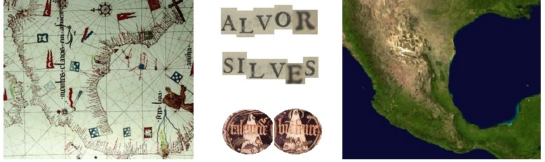
1. Turning a Reinel Map (1485)
Reinel's map of 1485 was found in a library in France, only in 1960. Some people tried to date it after 1500, however there is Moorish flag in Granada, that only fell in Spanish hands in 1492, the year Columbus departed... This is only inconvenient if you turn the map around, since you might see a nice Central America contour, some years before Columbus voyage...

Surely this is just a remarkable coincidence... as this knowledge would only be possible according to the official version, until at least 50 years after. Is it so?
2. Map of part of America - João de Lisboa (died 1525)
In a partial map of central/south America, João de Lisboa decided to put some Portuguese (and moorish) flags in Peru/Colombia... however since the spanish Pizarro expedition to the Incas occurred in 1529-32, this is also an inconvenient map. Despite the book where these maps are, called "Livro de Marinharia", was signed by João de Lisboa saying "made in 1514", the official cartography dates this as 1560... after the author was dead! Even so, this does not justify Portuguese or Moor castle in the Incas territory.

A map by João de Lisboa, in a book signed 1514.
(magenta squares show the portuguese/moor flag castles)
This is also a complementary proof to the Duchess Medina-Sidonia theory that the Moors were sailing to America before the Spanish... This was presented in the 500 anniversary of Columbus arrival, but kept aside from the general public! We believe that a Portuguese castle was the Castle of Saint George of the Mine - confusing itself with a similar name of a fortress in Africa. This was a general strategy - mixing african and american names.
3. Map of the World - João de Lisboa (died 1525)
In the same book by João de Lisboa, we find a remarkable world map:

World map by João de Lisboa, in a book signed 1514.
(yellow triangle is to be skipped and glued by the blue line spots)
Even if we accept the 1560 official date, this maps shows a very good world map, superior to most maps until Cook (1770). It has a contour of the western part of North America, that was "not allowed" after 1600... the contour does not close America to Asia, assuming an opening at the Bering Strait (Bering was born in 1680).
This map could never been dated to 1514, because it also shows the Magellan Strait, only crossed in 1521, and Japan, only uncovered in 1543. Unlike any other map around 1560 it does not mention the Magellan Strait, only the Cape of Good Hope... this is now justified, also Galvão (a portuguese hero of the XVI century) reports there were maps signaling Magellan Strait around 1428 - at that time it was called Dragon Cola (Dragon's Tail).
Furthermore, all small flags in this map are perfectly justified in a 1514 map, but not afterwards - for instance, Albuquerque conquests of 1515, in the Arabian peninsula, are not signaled.
--------- PART 2 --------
While facing a version of Columbus official History, we may choose to believe in different stories and films. It is well known that, before Columbus, regular voyages to the West were taking place, and the Portuguese knew exactly were Columbus had landed. In fact, King John II set immediately a fleet to the Antilles to prevent a second expedition. The official version has been ridicularized ever since, using an underground style in Art. For instance, the Harlequin, or Pulcinella, and his mistress Columbine (Pierrot's wife) try to tell part of the story, in a 16-17th century Comedy style.
A "Pulcinella secret" is understood to be a secret that almost everyone knows, but nobody acknowledges it... In this Columbine ball, the European courts found an amusing way to exclude the people from the truth. Moreover, in Spain, Pulcinella was also called Don Cristobal Polichinelo. Thus, you have the pair Don Cristobal and Columbine, it is not exactly Don Cristobal Columbus, but it would be difficult to be more explicit.
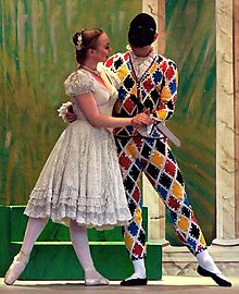
The Columbine ball.
(Disclaimer: no connection is intended with "Bowling for Columbine")
4. Pizzigano map
The oldest Portuguese chart held by Prince Henry in 1424 reports not only Madeira and Canary islands, but also Azores (only officially discovered in 1432). Moreover it signals as Archipelagos the Antilles in a red rectangle, and Satanazes in a blue one... almost 70 years before Columbus voyage.
In the map below we drew blue lines departing from a center marked in Spain (near Madrid, which was a small village at the time), crossing this blue "Satanazes" rectangle. This opens all directions to New Scotia and Newfoundland archipelagos. Likewise, from the same center, crossing the red "Antilles" rectangle, this leads directions to the same Antilles... that were uncovered (say discovered) by Columbus many decades later.
For sailor, directions were much more important than distances.

Pizzigano map 1424 - West lands: Antilles (red) and Satanazes (blue):
- (our) blue lines - directions to Newfoundland from a marked center in the map.
- (our) orange lines - directions to the Antilles from a marked center in the map
- (our) blue line - from the "Island Maydas"; (our) pink line - from the "Island Brazil".

The same lines in Google Maps, showing the directions to Newfoundland and Antilles.
Again, it is just a matter of common sense:
- Officially, since 1432 the Portuguese were sailing to Azores in a regular basis.
- Azores archipelago is almost in the middle of the Atlantic.
- You need much more navigation skills to find Azores in the middle Atlantic than to find America.
- A voyage from Lisbon to Azores would take approximately the same time as a voyage from Azores to Newfoundland.
- It is much more difficult to find small islands in the middle of the Atlantic than to find a huge continent like America, unless we admit a persistent navigation to the West.
Why is this is not being told?
... Well, it may be a ball, but we were not invited to dance, we are here to serve.
5. Anian Strait or Bering Strait
In the late 1597 the Portuguese cartographer Lavanha started a map that he called "Theatrum Mundi"... this is a good title, as Shakespeare plays were starting at the time.

Lavanha's map c. 1597-1612 (see full map in Theatrum Mundi)
This map is quite precise, except if you look at the bottom part, which may represent the Antartica continent (however, Australia seems to be always missing).
The most astonishing thing in this map is the precision with which the northern part of America is represented, suggesting that the Northwestern Passage, officially only discovered by Amundsen in the 20th century, was already known (at least 300 years before).
The Bering Strait is represented exactly, but since Vitus Bering would only be born almost 100 years later, it was then called Anian Strait. The map is much more precise than a 1570 Ortelius map, that also presents an Anian Regnum at the Strait location.
- What do people say about this?
Nowadays - nothing! In fact Portuguese navigations are kept hidden from almost every foreign course on History... sometimes people mention Prince Henry or that Columbus lived in Portugal.
This map is found in a huge collection called Portugaliae Monumenta Cartographica (1960), and you would expect to see some words about this there... well, you do not see anything, except some words concerning the history of the map itself, and its date.
It was dated between 1597-1612, and this would justify the presence of the Davis Strait (1587, however the handwriting is different), Nova Zemla uncovered in 1597, Hudson Bay (1611), but not the Baffin Bay (1616), not to mention the whole northwestern and northeastern passages.
- What did people say about this... in the past?
We cite the Portuguese mathematician Pedro Nunes in 1537:
"There is no doubt that the navigations of this kingdom, in the last 100 years, are the greatest, the most wonderful, most higher and discrete than any other people in the world (... The Portuguese) lost their fear so much that they went to the hottest places in the torrid zone and to the coldest places in the extreme south (...) And they made the sea so flat that today nobody dares to say that he discovered again some small island, some banks, or even cliffs, that were not previously discovered by our navigations".
Pedro Nunes died in 1578, the same year King Sebastian died in the Battle of Alcazar (this fact lead Portugal to be a part of the Spanish empire during 80 years). This foreign tragic event lead to one of the first English plays, by George Peele called The Battle of Alcazar (before Shakespeare's plays).
We are led to think that it would be quite difficult to produce an accurate map in frozen seas in the 16th century. Thus, we also present a detail of the so-called Cantino Map (Cantino was an italian spy, that sent a map to the Duke of Ferrara in 1502). This map presents Greenland with the most astonishing precision in 1502 (Corte-Real went there in 1500):

Greenland: in Cantino's map (1502); on the right: in Google Maps.
6. Hierusalem with a portuguese flag
We find in a map by João de Lisboa, a strange detail - a Portuguese blue flag in Jerusalem.

Detail in a map by João de Lisboa (c. 1514, Livro de Marinharia)
In the 12th century Crusades, the Kingdom of Jerusalem was conquered by King Baldwin, but it was then soon lost to Saladin (1187). From that date until Napoleon's short incursion into Palestine, and before the Balfour declaration (1917), it was never reported any other conquest.
However it is clear that this flag is not a coincidence.
It is known that Afonso de Albuquerque lead a huge war effort in the Red Sea, conquering even Suez (near the channel). When he was deposed by King Manuel, sending a new Vice-Roy to India in 1515, it is reported that he was intending to conquer Mecca from the Mamluks, and ask in exchange the Holy Land - Hierusalem.
Albuquerque is reported dead in 1515, in “grief with the replacement”... Soon afterwards, in 1517, the Ottomans defeat the Mamluks and assume the control of Jerusalem.
- What did happen? Are we allowed to guess?
We cite part of a message sent by the Shah of Persia, Ismail I (just before the battle of Chaldiran), to the Ottoman Sultan Selim I, in 1514:
I know the Truth as my supreme guide,
I would sacrifice myself in his way,
I was born yesterday, I will die today,
Come, whoever would die, here is the arena
As we know, Ismail was not the only one defeated in a battle in the name of Truth…
